Upload Shapefile coverage data
- Upload zipped folder that contains one or more shape file coverage data files
- Shapefile data should include DBF, PRJ, SHP, SHX files for each layer
- Wait for data processing to be completed
- Select the field and navigate to Tasks tab
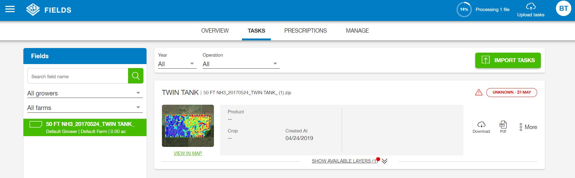
- Task type is shown as Unknown and User has to assign task type
- Hover the mouse on triangular notification sign
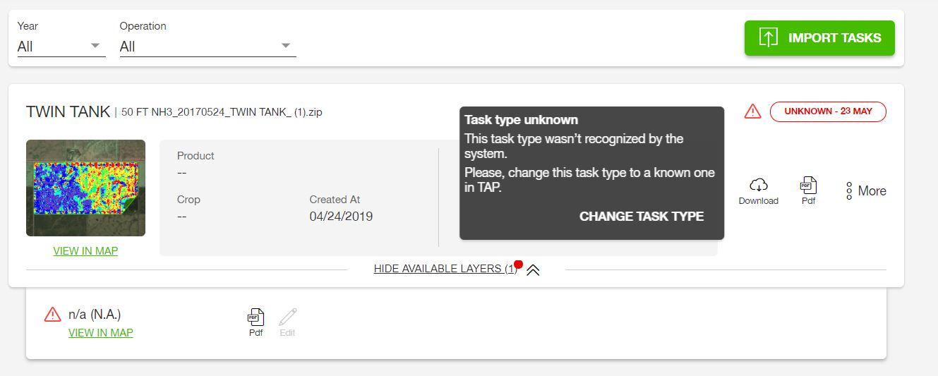
- Select Change Task Type
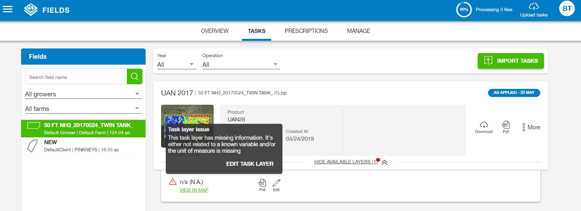
- Hover the mouse on notification for task layer type and edit task layer or select pencil sign to edit
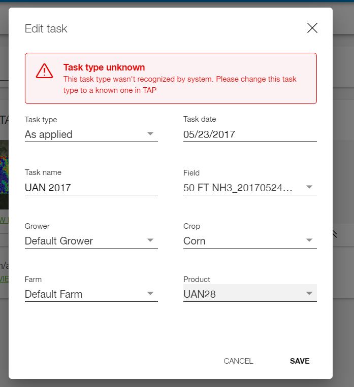
- Select collect layer type and correct units.
- Select Save
- Click View On Map to see the layer.
How did we do with this article?
 Cookies & Tracking